

The last week has caused many to struggle with whether to turn the heat on inside. Mornings have been quite chilly, and I am guessing several readers may have also struggled with the decision to wear a jacket as they started their workday. These are tough decisions, no doubt. Several data sources have suggested we have had at least 2 weeks of consecutive below-average daily mean temperatures. While not a record, this is certainly noticeable! Perhaps we are hoping those tomato plants will produce just a few more tomatoes. Is it mum season, already? The good news – for those not quite ready to say goodbye to warm days, not needing coats, and garden delights – is warm temperatures are expected to return. Daily high temperatures are already in the 80s and Indiana is likely to see temperatures in the mid-90s by next week. There is significant confidence that this warmer-than-normal temperature trend is likely to continue through most of September. Average high temperatures typically range from 75°F – 85°F in mid-September and 70°F – 75°F in late September, so keep in mind climate outlooks are all relative. Indiana is not likely to experience triple-digit heat waves over the next few weeks, but nighttime low temperatures are likely to fight for temperatures warranting a sweater or jacket.
There’s been a noticeable lack of precipitation with Indiana receiving well below-normal precipitation throughout the state over the past 30 days except for the northwestern counties. This has led to expansion of both Abnormally Dry (D0) and Moderate Drought (D1) areas across the state (Figure 1). Unfortunately, both forecasts and climate outlooks suggest this below-normal precipitation pattern is likely to continue for a while. Over the next 7 days, very little precipitation is expected across much of Indiana (Figure 2). This below-normal precipitation pattern is likely to continue through most of next week. After that, climate outlooks are favoring near-normal precipitation through September 24th.
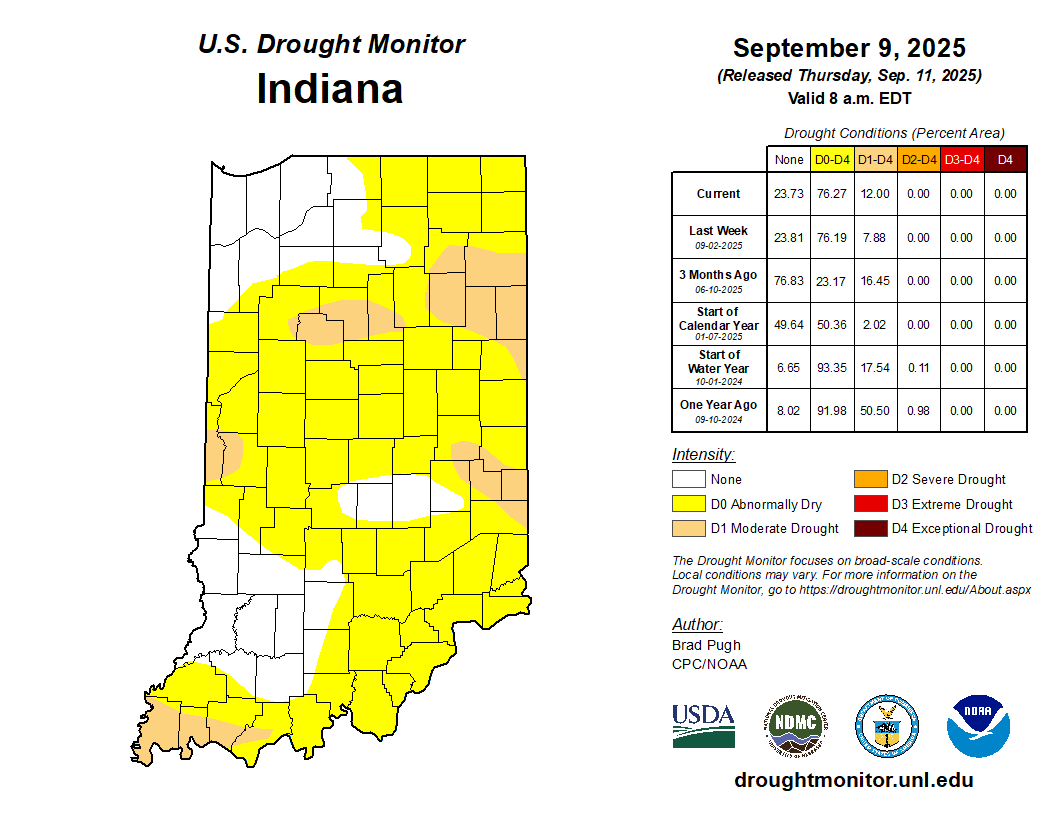
Figure 1. U.S. Drought Monitor status for conditions as of Tuesday, September 9, 2025.
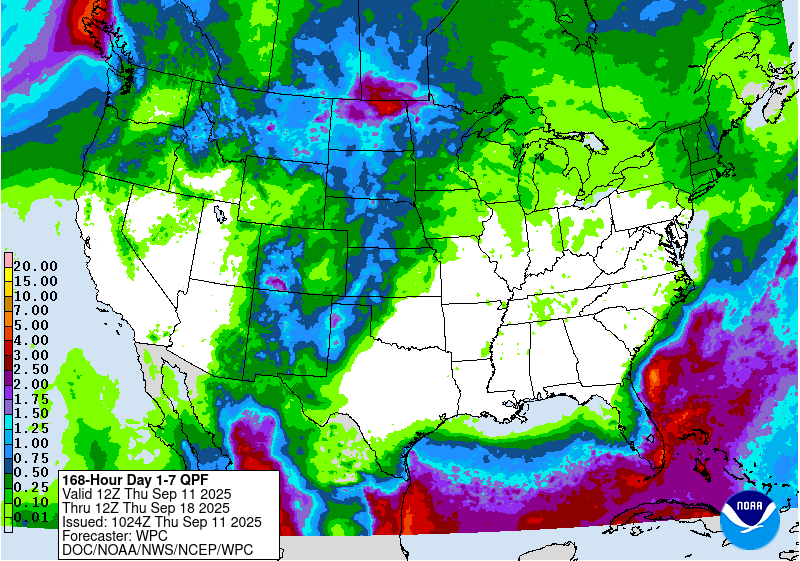
Figure 2. Total precipitation amounts forecasted for September 11-18, 2025.
Regarding first frost or even hard frost, we are still too early in the calendar year to worry about this being an extensive risk. Very localized, low-lying areas may be susceptible, but the climatological average date of the first hard freeze (28°F) is often not until mid-to-late October (Figure 3). With temperatures expected to warm again, widespread hard frost is not anticipated prior to October.
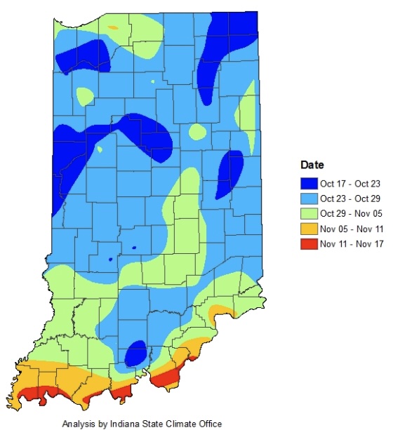
Figure 3. Average date of the first fall frost where temperature first reach or drop below 28°F.
