

Despite the wet start to the month, the entire state saw less than 50 percent of normal rainfall from April 10 to 16, and in some cases, less than 10 percent of normal rainfall (Figure 1). This was helpful, especially as some locations still deal with river flood warnings and ponded and saturated fields. This has severely limited most field activity this month.
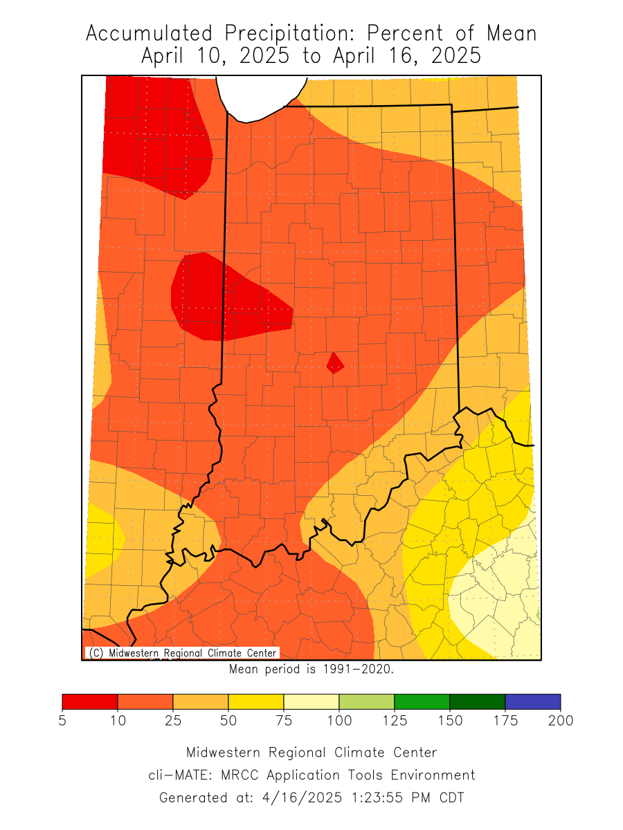
Figure 1. April 10-16, 2025, accumulated precipitation represented as the percent of the 1991-2020 climatological normal.
Overnight temperatures have been cold enough for the National Weather Service (NWS) to issue freeze warnings and frost advisories because vegetation is actively growing and vulnerable to freeze damage. As a reminder, we won’t escape the risk of frost until mid-May, so you may need to keep covering your perennials. Pay attention to the latest alerts from your local NWS office.
As of April 16, the seven-day average 2-inch soil temperatures under sod have risen above 50°F in southern Indiana over the past week. Posey County has the warmest 2-inch soil temperature at 54.1°F, while LaPorte County has the coolest at 45.8°F (Figure 2), which is on track for the climatologically expected dates for this to occur. March temperatures were 5.7°F above normal, making it the 11th warmest March on record, which helped soil temperatures warm. However, temperatures have averaged 1-3°F below normal for the first 15 days of April, slowing the progress of soil temperature warming. The same can be said for the impact on modified growing degree days (50F, 86F) as accumulations are more than 25 units below normal for the entire state (Figure 3).
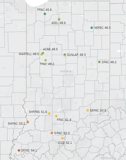
Figure 2. April 16, 2025, 7-day average 2-inch soil temperature under sod.

Figure 3. Left – Accumulated modified growing degree days from April 1-15, 2025. Right – Accumulated modified growing degree days from April 1-15, 2025, represeted as the departure from the 1991-2020 climatological normal.
Shifting to the outlook, temperatures are expected to bounce back, and so will precipitation. Over the next seven days, warmer temperatures will remove the threat of a hard freeze, with highs in the 60s and 70s across the state. Forecast precipitation totals from April 17-24 look to be heaviest in west-central Indiana, with totals ranging from 1 to 4 inches (Figure 4). This will fall on saturated topsoil and thus create a continued concern for flooding and delayed field progress. Hopefully, we can kick the current abnormally dry conditions across north-central Indiana to the curb. The Climate Prediction Center is confident that above-normal temperatures and above-normal precipitation will continue until the month’s end, so fieldwork windows will be short and minimal (Figure 5).
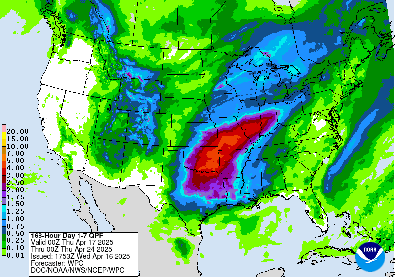
Figure 4. The Weather Prediction Center’s 7-day quantitative precipitation forecast from April 17-24, 2025.

Figure 5. The Climate Prediction Center’s 7-10 and 8-14 temperature and precipitation outlooks released on April 15, 2025.
