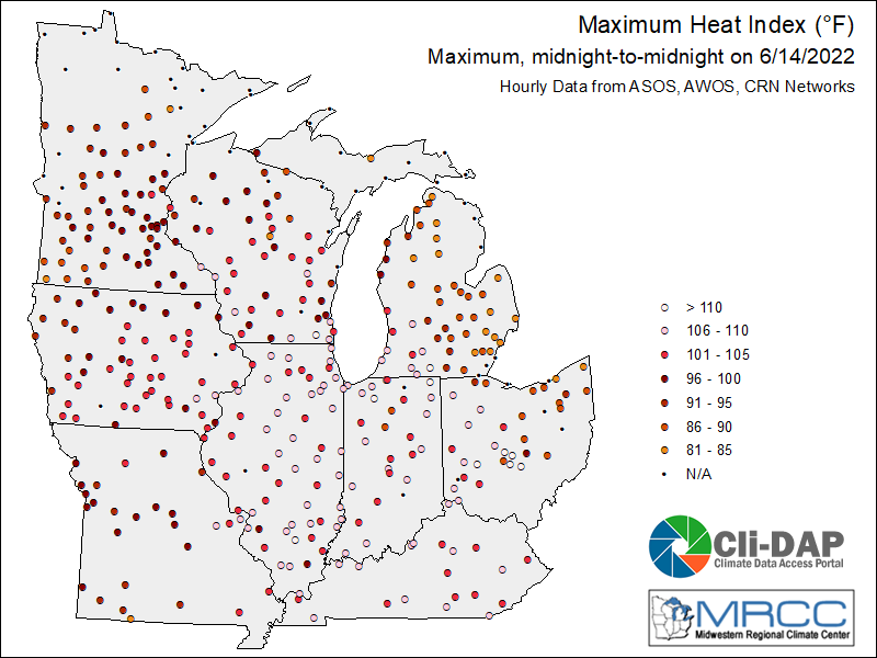
There is no shortage of weather to discuss this week! Heavy damage to buildings, trees, and power lines was reported in northern Indiana as a result of the Derecho that occurred on June 13. Unfortunately, there was a fatality associated with the storm. Fort Wayne International Airport recorded a 98-mph wind gust, which broke their record wind speed of 91 mph set in 2012. These storms coincided with excessive heat warnings for the entire state. Most stations had heat indices exceeding 100◦F for 3-4 days (June 13-17). On June 14, all Indiana weather stations recorded heat indices ranging from 106-110◦F and two northern Indiana stations had heat indices in excess of 110◦F (Figure 1).
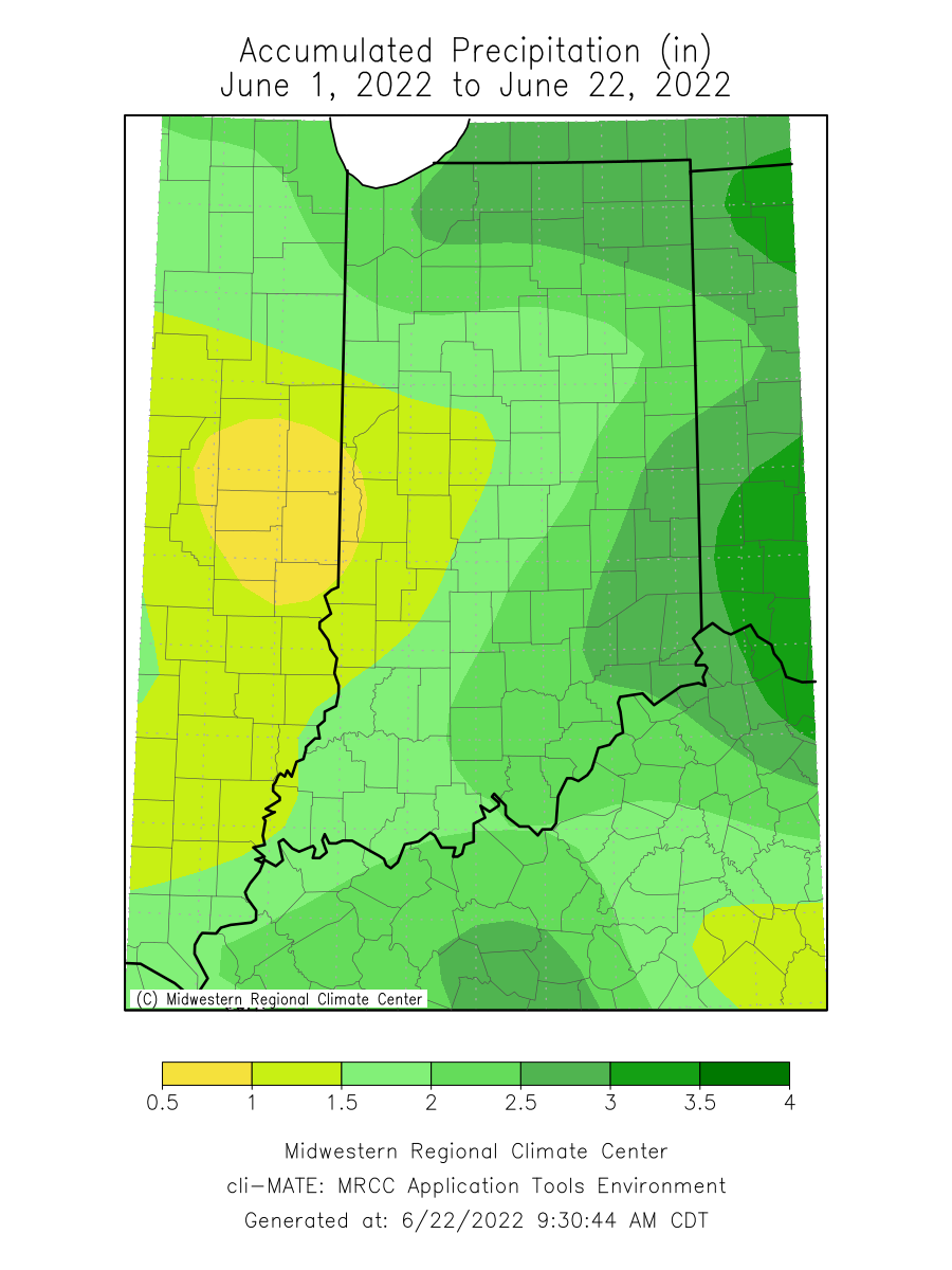
June 2022 rainfall has been highly variable across the state (Figure 2). The heaviest precipitation was recorded in the north and southeastern parts of the state. Central, western, and southwestern Indiana all saw rainfall totals that were less than 2 inches, which was less than 50 percent of the normal precipitation for June 1-22 (Figure 3). Because of this and other environmental factors, abnormally dry conditions have been introduced to the current U.S. Drought Monitor for west-central and southern Indiana.
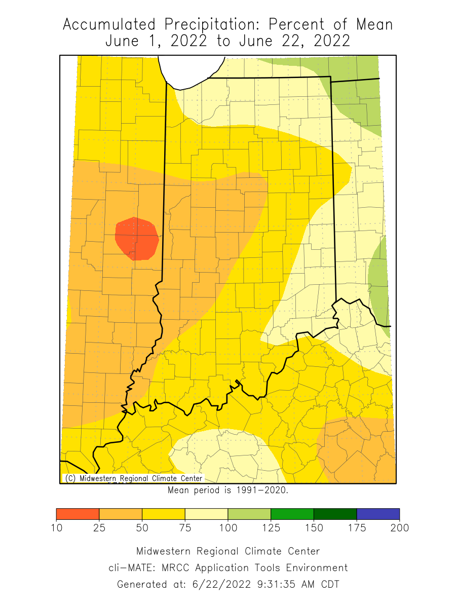
Figure 3. Precipitation for June 1-22, 2022 represented as the percentage of what normally fell during that period from 1991-2020.
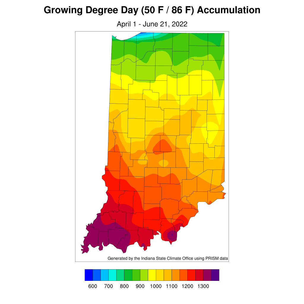
Modified Growing Degree Days (MGDDs) since April 1 (Figure 4), have been tracking near normal to slightly below normal in the northern part of the state (Figure 5). From central to southern Indiana, MGDDs are near normal to 60 MGDDs above normal. Isolated locations in central Indiana are running 60-90 MGDDs above normal.
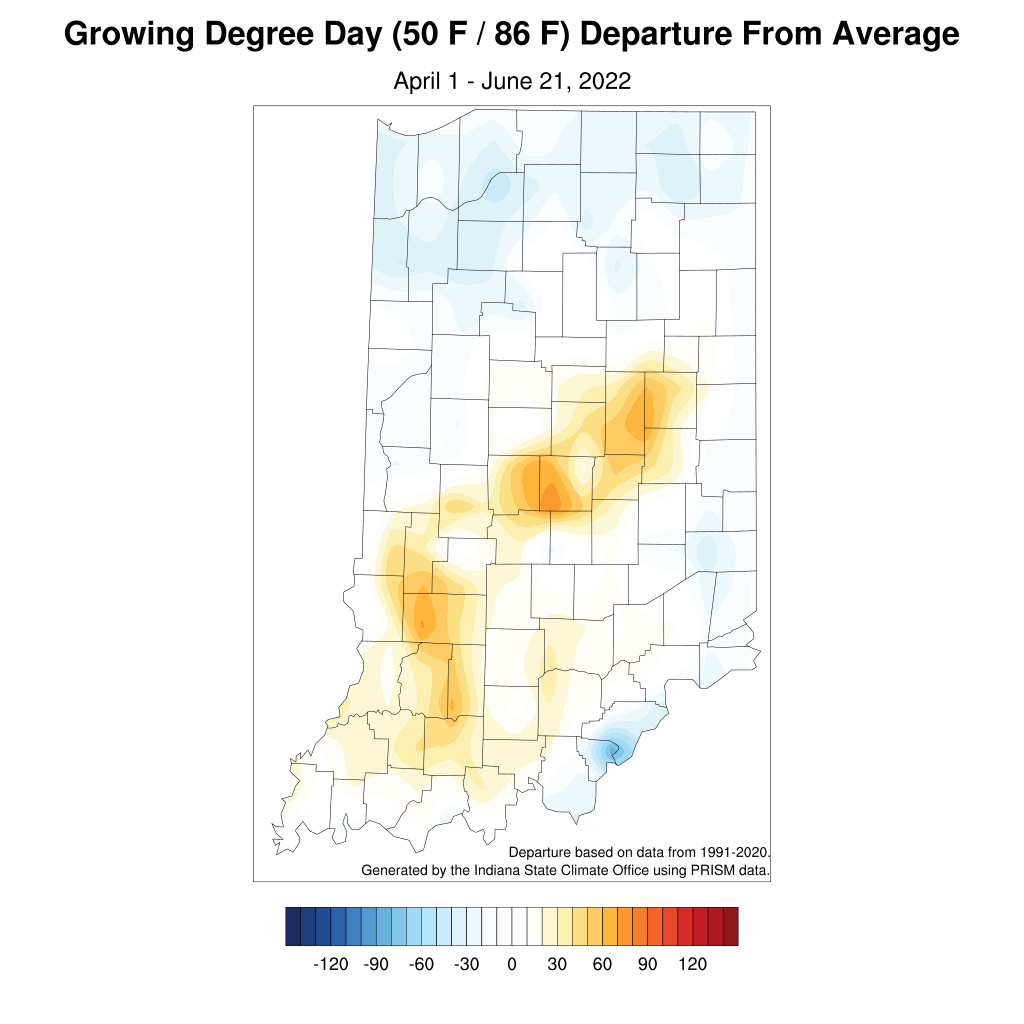
Figure 5. Modified growing degree day (50◦F / 86◦F) accumulation from April 1 – June 21, 2022, represented as the departure from the 1991-2020 climatological average.
The Climate Prediction Center Outlooks highlight elevated confidence in below normal precipitation through the beginning of July. Because of this, it is highly likely that drying conditions will continue across the state and may see worsening conditions in the U.S. Drought Monitor. New maps are released every Thursday. Stay tuned…


