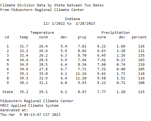
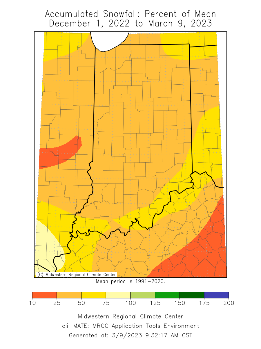
As meteorological winter officially ended on Feb 28, we still have a few more official days of winter left. Winter has been mostly warm and wet as statewide temperatures ran 6.1◦F above normal and precipitation averaged 115 percent of normal (Figure 1). The warmer temperatures have limited snowfall accumulations to less than half of normal for a large portion of the state (Figure 2). The largest deviations are near lake Michigan as snowfall totals are 20-25 inches below normal for the winter.

Figure 1: Indiana temperatures, normal temperatures, temperature deviations, precipitation, normal precipitation, precipitation deviations, and percent of normal precipitation by climate division for December 1, 2022 – February 28, 2023.

Figure 2: Accumulated snowfall for December 1, 2022 through March 9, 2023 represented as the percent of mean snowfall from the 1991-2020 normal snowfall.
February was exceptionally windy as the state contended with several storm events that passed through. Indianapolis had 17 days where wind gusts were greater than or equal to 30 mph, 6 days greater than or equal to 40 mph, and two days with winds in excess of 50 mph. February 9th had a 54-mph wind gust and February 27 observed a 56-mph wind gust.
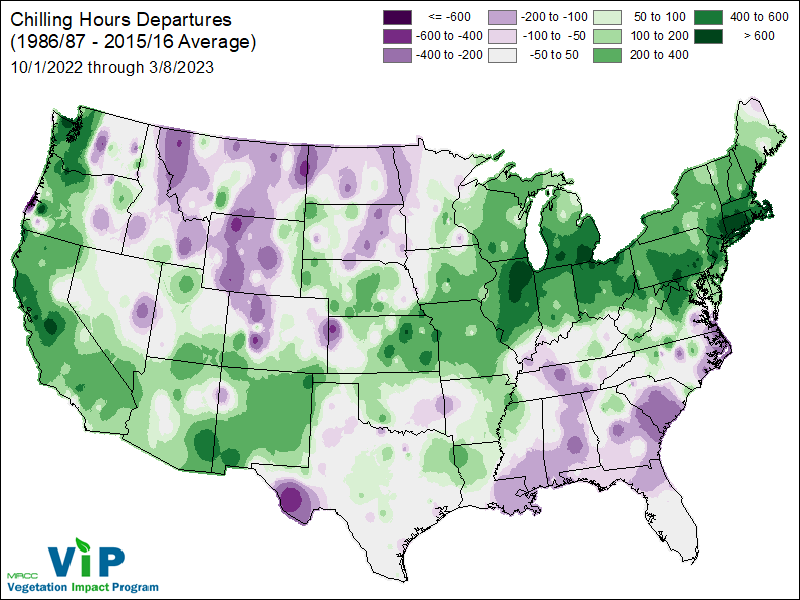
Temperatures have been in the sweet spot for chilling hours to accumulate this winter and are running above normal across most of the state (Figure 3). What does this mean? It means that many of our perennial crops have reached the number of hours exposed to temperatures within an ideal range during dormancy. That’s a good thing, right? Maybe. We still have a lot of time before the probability of a hard freeze/frost is eliminated and could cause trouble for perennial crops. Reports of bud-break on perennial crops are under way in southern Indiana. Over the coming weeks, there will likely be frost/freeze advisories creeping into southern Indiana.

Figure 3: Accumulated chilling hours for October 1, 2022 through March 8, 2023 represented as the departure from the mean chilling hours accumulated between 1986/87-2015/16.
Below-normal temperatures are expected through the next 14 days along with near normal chances of precipitation. Weather models are indicating a significant cool down with low temperatures in the teens, statewide, during mid-March. It may look like early spring, but winter is not over yet! A full spring outlook was released last week, written by Hans Schmitz.
The good news… Indiana is officially drought free for the first time since May 17, 2022 with the March 9 US Drought Monitor release.


